The Ogliastra
 Arriving at Ogliastra is always hard, it is necessary to take roads with
continuous ascent and descent hairpins. Leaving from Cagliari or from Cala
Gonone, you arrive at Arbatax, with the possibility of observing the beauty
upsetting of the coasts, which change appearance and colour, from the red
rocks of porphyry in the south, to the high limy reefs, interrupted by
splendid coves, in the northern side.
Arriving at Ogliastra is always hard, it is necessary to take roads with
continuous ascent and descent hairpins. Leaving from Cagliari or from Cala
Gonone, you arrive at Arbatax, with the possibility of observing the beauty
upsetting of the coasts, which change appearance and colour, from the red
rocks of porphyry in the south, to the high limy reefs, interrupted by
splendid coves, in the northern side.
The Hinterland deserves an attentive visit. The reasons of interest are above all naturalistic.
A few kilometres from the seaside, there is a succeeding of mountain landscapes with green
woods and vast panoramic openings.
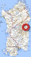
Road Map
|

|
 THE STEP OF CORRU 'E BOI
From Nuoro you take the government street to Mamoiada. Across pastures and
vineyards you continue for some kilometres on the road to Fonni. You carry
on ascending to the step of Caravai and arrive at 1246 metres of the Arcu
Corru 'e Boi, the so-called "step of the Horn of Ox", the high pass between
the mountains of Gennargentu and Supramonte which puts in communication the
Nuorese and the Ogliastra district. Hence it begins the descent along the
Rio Calaresu valley. On the right there are the highest peaks of
Gennargentu bulky.
VILLAGRANDE STRISAILI
A short 4 Km deviation on the left at Villagrande Strisaili. Along the road
you cross a small plateau with lollipops woods around the St Barbara Church.
Here it is possible to enjoy lovely walks in the woods and on the mountains
that offer spectacular panoramic openings.
LANUSEI
Coming down long the reforested valley of pines, you reach Lanusei. It is a
holiday resort frequented by people who love green and quiet mountain
villages. The sea is however at a distance of 20 Km. The mountains at the
shoulders are covered by lollipops forests. In the narrow Ibono valley
you can see some Nuraghes and some domus de janas.
GAIRO
From Lanusei you go back up to the Gairo fork. The road goes down steep and
the view spreads over the Ogliastra mountains, to the splendid and idolated
tower of Perda Liana. Two towns are located along the steep slopes of the
Rio Pardu valley, Gairo Sant' Elena and Gairo. The first one was rebuilt
around the fifties to accommodate the inhabitants of the most downstream
country, destroyed in part by a landslide caused by torrential rains and by
the destruction of the woodland cloak. Gairo appears like a phantom town
with the empty houses without any windows or doors.
SEUI (detour)
The Seui detour is reached after 33 Km. It is a hard route for its frequent
hairpins, but definitely advisable for people who love mountain landscapes.
The views are wonderful.
ULASSAI
Continuing towards Ierzu you cross Osini, in part stopped and rebuilt as
Gairo. A road on the right passes through the mountains and arrives at some
small caves. In Ulassai it is possible to stop and visit the cave of Su
Marmuri, one of the most attractive ones of the island with beautiful
stalagmites and stalactites hanging from the vaults.
PERDASDEFOGU (detour)
A 25 km detour takes you to Perdasdefogu, one of the most isolated centres
in Sardinia, which for the vast and uninhibited hinterland has been chosen
as the seat of the Experimental Polygon for shooting missiles.
IERZU
Ierzu is the most important centre of the Rio Pardu valley. Its reputation
is bound above all to the production of an excellent quality of Cannonau, a
heavy Doc wine.
TERTENIA (detour)
Keeping on Tortolì, a 10 Km detour takes to Tertenia. From the town a road
goes to the sea and to nice villages with isolated beaches and reefs. Along
the coast there are some interesting Nuraghes.
BARÍ SARDO
Continuing across the plain you arrive at Barì Sardo, agricultural center
surrounded by gardens and vineyards. The village takes its name from an
attractive Spanish tower on a small promontory detached from a sandy coast.
TORTOLÍ and ARBATAX
Gone out from Barì Sardo, after some kilometres you see on the right some
menhir driven into the ground. Tortolì is the most important centre of the
Ogliastra district. In the south of the town you can see some interesting
domus de janas, menhir and two graves of giants. The road continues in
direction of Arbatax, a gracious town grawn up around the Spanish tower of
the 6th century and the port.
HOLY MARIA NAVARRESE
Keeping on the Eastern Sardinia mainroad in direction of Olbia, you note on
a small hill some ruins of the Medusa medieval castle, built by the judges
of Cagliari to defend the northern boundaries of their kingdom. You arrive
in this way to Holy Maria Navarrese. The glamour of the small centres is
due to be immersed in ancient wild olives and to the position on the sea, to
the beach limits of the plain and the rocks that precede the steep rising of
the limy coasts. Holy Maria is the point of boarding for Cala Luna and the
other small beaches more in the north, reachable only by sea.
BAUNEI
The road climbs steeply opening the view, that spaces from the Ogliastra
island to the Arbatax promontory, to the Rio Pramaera valley. Baunei is a
suburb which has a large and attractive common territory, extended on limy
plateau that continues Supramonte until the sea. Savage crests, gorges
excavated by torrents that run through oleanders to the attractive coves
on the sea, a very special flora and an ancient fauna make of this region
one of the most interesting on the whole island - from the naturalistic
point of view.
URZULEI (detour)
We want to propose a detour that runs to the town of Urzulei and to Genna
Silana, at 1017 meters. On both sides of the road there are harsh rocky
hills, on the left the view spaces to the sea. The whole breathtaking route
runs trough deep woods and green mountains with frequent caves.
You must take the government street 125 to return to Nuoro up to Tortolì and
continue in direction of Lanusei.
|
|
|
|
|
